Marco Island, FL Map
These maps of Marco Island, FL, and nearby beaches are designed to help you navigate Florida’s coastline. Use these detailed maps to discover beachfront resorts and points of interest for your next getaway to the Sunshine State.
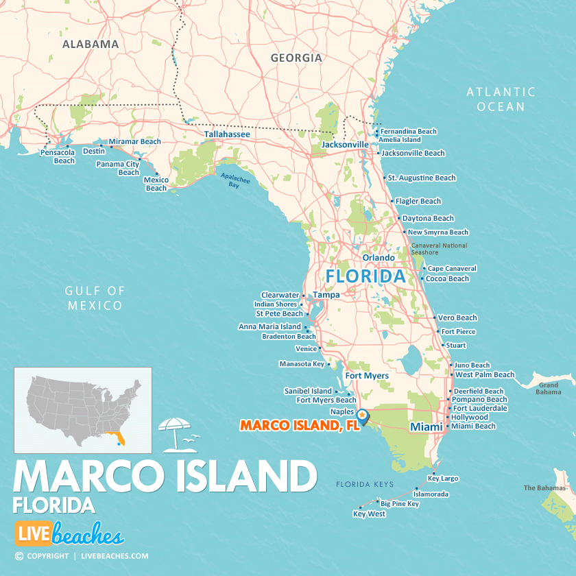
Click Map To Enlarge
Visit Marco Island, Florida
Easily find beachfront hotels in Marco Island using our interactive map. Filter by budget, location, and crew size to plan your perfect Florida getaway.
How Big is Marco Island?
Marco Island in Florida spans approximately 23 square miles.
Beach Length: N/A | Beachfront Width: the actual width varies by location and tide.
![]()
What is the sand like?
Marco Island boasts expansive, stunning expanses of fine quartz sand that are wonderfully soft and powdery, reminiscent of powdered sugar. This sand remains pleasantly cool under the sun, and the serene, emerald-green waters of the Gulf of Mexico create an ideal setting for unwinding, swimming, and collecting shells.
Maps of Popular Beaches in Florida
Explore additional maps of Florida’s top beaches to help you plan your perfect getaway.