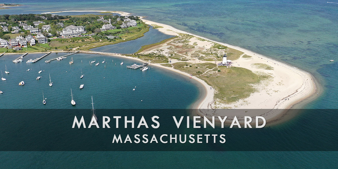
Discover Martha’s Vineyard, MA
Off the coast of Massachusetts, Martha’s Vineyard is a well-liked island retreat that is renowned for its breathtaking scenery, charming historic district, immaculate beaches, and laid-back vibe. Discover Edgartown’s ancient streets, which are dotted with restaurants, boutique stores, art galleries, and residences from the 18th and 19th centuries. Admire the harbor views while at the Edgartown Lighthouse.
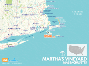
![]() Map of Martha’s Vineyard, Massachusetts
Map of Martha’s Vineyard, Massachusetts
Oak Bluffs is well-known for its vibrant gingerbread homes in the Martha’s Vineyard Camp Meeting Association. It also has beaches, America’s oldest carousel, the Flying Horses Carousel, and Circuit Avenue, which is lined with stores and restaurants. Vineyard Haven, the principal port town with ferry terminals, is home to galleries, stores, and the Martha’s Vineyard Museum, which highlights the history, culture, and maritime legacy of the island.
Popular for its large expanse of sandy shoreline, waves, and dunes, South Beach is close to Edgartown. It’s perfect for beachcombing, swimming, and tanning. See the remarkable Aquinnah Cliffs, renowned for their multicolored clay strata and expansive ocean views, when you visit Aquinnah. Discover the beautiful bike routes and trails on Martha’s Vineyard, such as the 5.2-mile paved route that runs from Oak Bluffs to Edgartown and provides views of the island’s beaches, farms, and woodlands.
Shop for locally grown produce, artisanal delicacies, and handmade items at farmers’ markets in different communities. Savor freshly caught seafood at seaside eateries and seafood shacks that provide locally caught fish, clam chowder, and lobster rolls. A favorite spot for exploration and leisure on the New England coast, Martha’s Vineyard provides a unique combination of outdoor activities, cultural legacy, and scenic beauty.
Visitors are encouraged to pick up a free destination guide from the visitors or tourism information center. Local guides include accommodations, attractions, water activities, calendar of events & festivals, and popular restaurants.
![]()
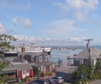
Live Webcams
View live webcams from Martha’s Vineyard, Massachusetts. Check the current weather conditions, beach activity, and enjoy spectacular sunsets and sunsets. It’s not quite the same as being here but it’s a great way to daydream from far away!
![]()
Map of Martha’s Vineyard & Nearby Beaches
Use the map as a guide to find the best beaches in Massachusetts, locate nearby cities and points of interest.
• Martha’s Vineyard, MA Map
• Map of Beaches in Massachusetts
![]()
Martha’s Vineyard, MA Average Temperatures
Wondering the average monthly temperatures in Martha’s Vineyard, MA? Use this chart below to view the average daily high and low air temperatures including the average ocean temperature per month.
• Average High Temperatures per Month
• Average Low Temperatures per Month
• Average Ocean Temperatures
Martha’s Vineyard, Massachusetts Average Temperatures
Use this weather chart as a guide to view the average air and ocean temperatures in Martha’s Vineyard, MA.
The average air temperature in the summer varies between 75-80 degrees.
The average ocean temperature in the summer varies between 65-70 degrees.
| Average High | Average Low | Average Ocean Temp | |
|---|---|---|---|
| January | 35 | 23 | 38 |
| February | 40 | 26 | 37 |
| March | 48 | 30 | 40 |
| April | 55 | 36 | 47 |
| May | 65 | 45 | 57 |
| June | 72 | 55 | 64 |
| July | 81 | 61 | 68 |
| August | 80 | 60 | 71 |
| September | 73 | 57 | 66 |
| October | 63 | 43 | 59 |
| November | 54 | 38 | 52 |
| December | 43 | 28 | 43 |
Average high, low and ocean temperatures in Martha’s Vineyard. Sources: Accuweather, Weather.com, NOAA Climate.gov.


