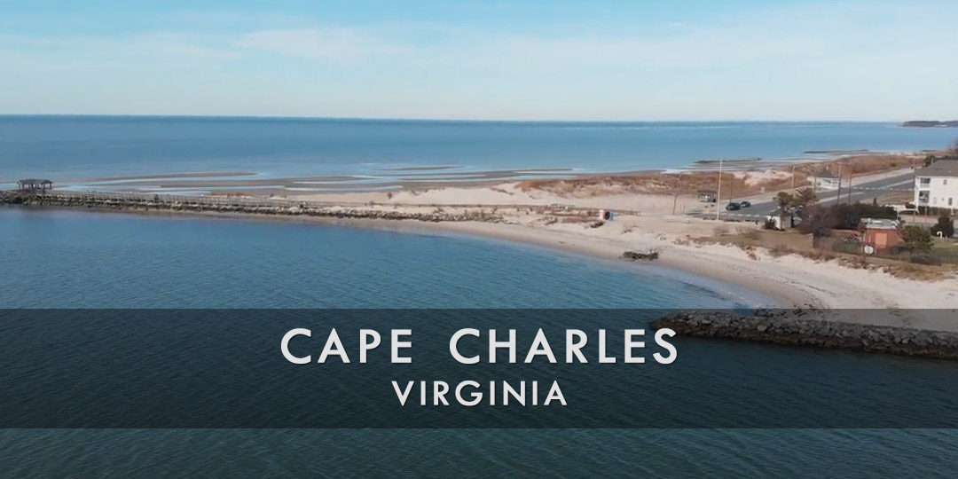
Discover Cape Charles
Cape Charles is located on the southern tip of Virginia’s Eastern Shore and the shores of the Chesapeake Bay. Cape Charles is a popular destination throughout the year, but it attracts most of its visitors during the summer season.
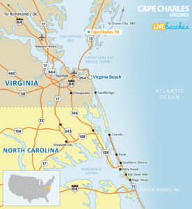
![]() View Map of Cape Charles, Virginia
View Map of Cape Charles, Virginia
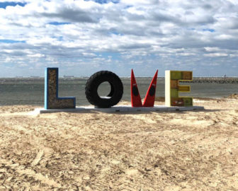
Historic Cape Charles features turn-of-the-century architecture and offers visitors art galleries, boutiques, ice cream and coffee shops, and the famous Love Sign, located next to the Cape Charles fishing pier.
Cape Charles offers a free public beach in the historic district. The beach is safe for families with small children. Residents and visitors can use the beach area for swimming, sunbathing, and watching the sunset.
Planning a day trip to Cape Charles from Virginia Beach or Norfolk? The Chesapeake Bay Bridge Tunnel connects Virginia’s Eastern Shore with the Virginia mainland near Virginia Beach and Norfolk. The bridge-tunnel is 18 miles long (toll booth to toll booth) from shore to shore and takes approximately 30 minutes to cross.
The Chesapeake Bay Bridge-Tunnel takes about 30 minutes to cross directly. The bridge-tunnel was once considered one of the world’s seven engineering wonders.
Visitors are encouraged to pick up a free destination guide from the local visitors center or tourism information center. Local guides include accommodations, attractions, water activities, events & festivals, and popular restaurants.
![]()
Live Webcams
View live webcams from Cape Charles, Virginia. Check the current weather conditions, beach activity, and enjoy spectacular sunsets and sunsets. It’s not quite the same as being here but it’s a great way to daydream from far away!
![]()
Map of Cape Charles & Nearby Beaches
Use the map as a guide to find the best beaches in Virginia and locate nearby cities and points of interest.
• Cape Charles, VA Map
• Map of Beaches in Virginia
![]()
Cape Charles, VA Average Temperatures
Wondering the average monthly temperatures in Cape Charles, VA? Use this chart below to view the average daily high and low air temperatures including the average ocean temperature per month.
• Average High Temperatures per Month
• Average Low Temperatures per Month
• Average Ocean Temperatures
Cape Charles, Virginia Average Temperatures
Use this weather chart as a guide to view the average air and ocean temperatures in Cape Charles, VA.
The average air temperature in the summer varies between 85-90 degrees.
The average ocean temperature in the summer varies between 70-75 degrees.
| Average High | Average Low | Average Ocean Temp | |
|---|---|---|---|
| January | 50 | 32 | 42 |
| February | 53 | 33 | 44 |
| March | 59 | 39 | 47 |
| April | 68 | 48 | 55 |
| May | 75 | 56 | 60 |
| June | 84 | 66 | 71 |
| July | 88 | 71 | 76 |
| August | 86 | 69 | 79 |
| September | 80 | 63 | 72 |
| October | 70 | 53 | 62 |
| November | 63 | 43 | 53 |
| December | 54 | 35 | 49 |
Average high, low and ocean temperatures in Cape Charles. Sources: Accuweather, Weather.com, NOAA Climate.gov.


