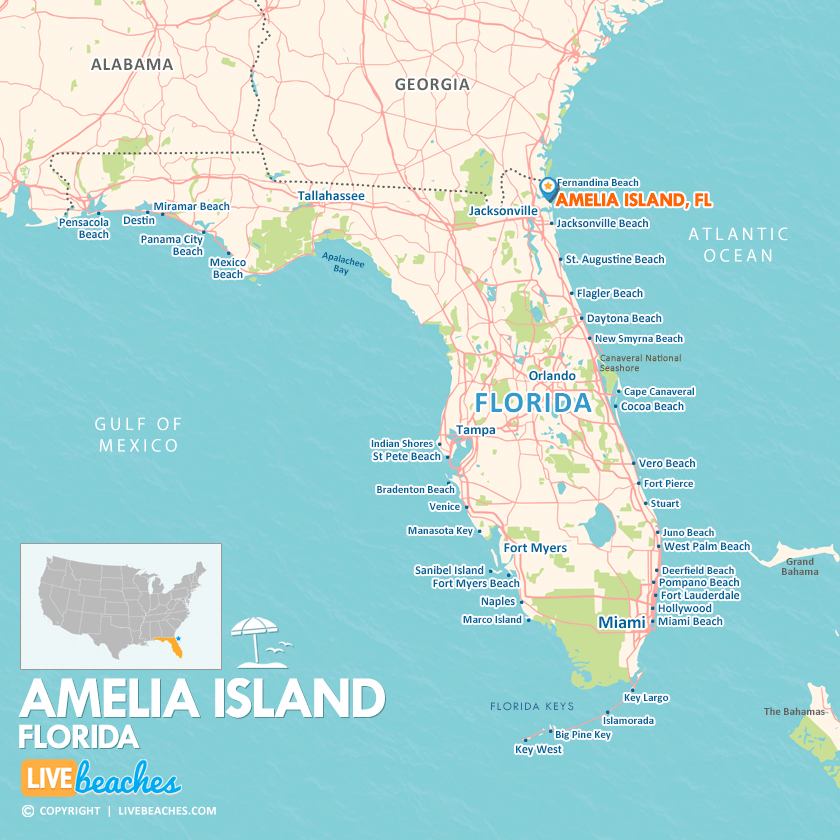
Amelia Island, FL Map
Map of Amelia Island and popular nearby beaches in Florida. Use these regional maps as a guide to learn the area and points of interest along the Florida Coast.
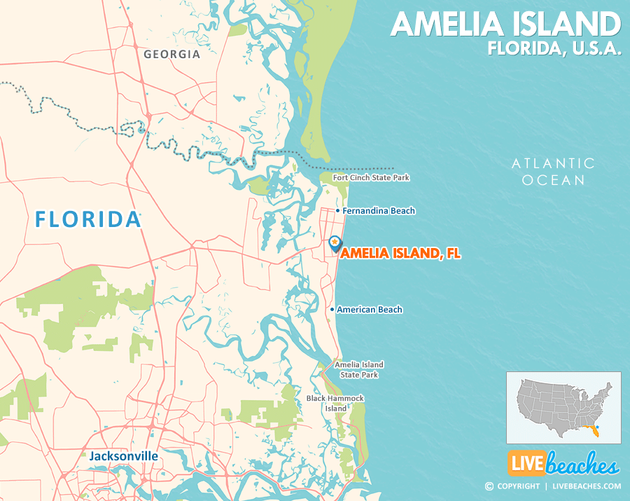
Visit Amelia Island, Florida
Easily find beachfront hotels in Amelia Island using our interactive map. Filter by budget, location, and crew size to plan your perfect Florida getaway.
How Big is Amelia Island?
Amelia Island covers a total land area of approximately 18 square miles.
Beach Length: 13 miles | Beachfront Width: Ranges from 125-150 feet
![]()
What is the sand like?
The sand on Amelia Island is wonderfully compact, making it perfect for a leisurely horseback ride along the beach or a scenic bike ride along the coast. It’s also sturdy enough to accommodate vehicles, with designated parking areas at locations such as Peters Point and Amelia Island State Park.
Maps of Popular Beaches in Florida
Explore additional maps of Florida’s top beaches to help you plan your perfect getaway.