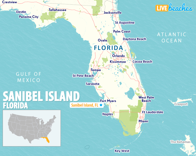
Sanibel Island, FL Map
These maps of Sanibel Island, FL, and nearby beaches are designed to help you navigate Florida’s coastline. Use these detailed maps to discover beachfront resorts and points of interest for your next getaway to the Sunshine State.
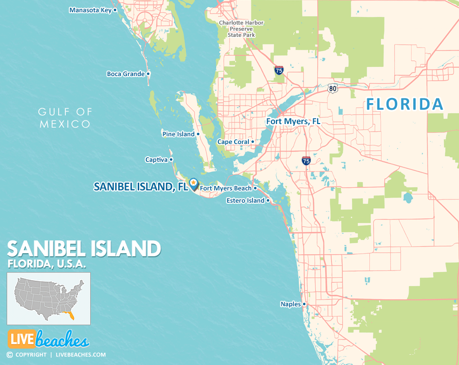
Click Map To Enlarge
Visit Sanibel Island, Florida
Easily find beachfront hotels in Sanibel Island using our interactive map. Filter by budget, location, and crew size to plan your perfect Florida getaway.
![]()
What is the sand like?
Sanibel Island is famously known as the “Seashell Capital of the World.” Unlike the pristine, fine white silica sands found on certain beaches along the Florida Gulf Coast, the sand at Sanibel is largely composed of soft, crushed seashells mixed with quartz. This combination gives it a slightly coarser texture and a beautiful, natural appearance.
Maps of Popular Beaches in Florida
Explore additional maps of Florida’s top beaches to help you plan your perfect getaway.