Discover Murrells Inlet
Situated south of Myrtle Beach on the South Carolina coast, Murrells Inlet is a charming fishing community. Murrells Inlet, also referred to as the “Seafood Capital of South Carolina,” is a quaint combination of breathtaking scenery, a rich past, and delectable food.
![]() Map of Murrells Inlet, South Carolina
Map of Murrells Inlet, South Carolina
Take a fishing charter excursion off of Murrells Inlet and test your skills at inshore, stream, and deep-sea fishing. Skilled captains will lead you to the best fishing locations so you can enjoy an unforgettable day on the water.
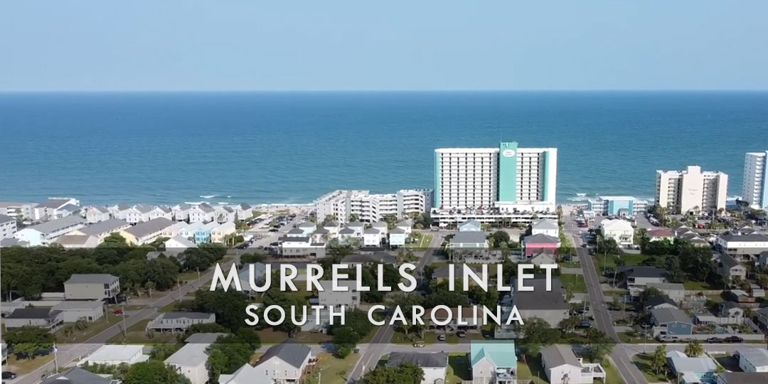
Photo Credit: Richard Greene @rlgreene21
To explore Murrells Inlet’s waterways at your speed, rent a kayak or boat. Discover undiscovered nooks, paddle through picturesque marshlands, and take in the inlet’s natural splendor. Riding along attractive routes like the Waccamaw Neck Bikeway, which provides breathtaking views of the marshes, rivers, and estuaries surrounding Murrells Inlet, is a great way to take in the natural beauty of the area.
Visit one of the well-known seafood restaurants in Murrells Inlet to taste fresh seafood that has been caught nearby by the local fisherman. Delicious alternatives abound, ranging from fish and crab to oysters and shrimp. In Murrells Inlet, peruse neighborhood art galleries and boutiques to discover one-of-a-kind pieces, handcrafted items, and mementos that pay homage to the coastal way of life.
Savor live music events, festivals, and other activities that highlight local talent and highlight Murrells Inlet’s dynamic culture all year long. With its beautiful beauty and seaside charm, Murrells Inlet has something to offer everyone, whether they are outdoor enthusiasts, seafood lovers, or art enthusiasts.
![]()
Live Webcams
View live webcams from Murrells Inlet, South Carolina. Check the current weather conditions, beach activity, and enjoy spectacular sunsets and sunsets. It’s not quite the same as being here but it’s a great way to daydream from far away!
![]()
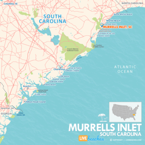
Map of Murrells Inlet & Nearby Beaches
Use the map as a guide to find the best beaches in South Carolina and locate nearby cities and points of interest.
• Murrells Inlet, SC Map
• South Carolina Beaches Map
![]()
Murrells Inlet, SC Average Temperatures
Wondering the average monthly temperatures in Murrells Inlet, SC? Use this chart below to view the average daily high and low air temperatures including the average ocean temperature per month.
• Average High Temperatures per Month
• Average Low Temperatures per Month
• Average Ocean Temperatures
Murrells Inlet, South Carolina Average Temperatures
Use this weather chart as a guide to view the average air and ocean temperatures in Murrells Inlet, SC.
The average air temperature in the summer varies between 85-90 degrees.
The average ocean temperature in the summer varies between 75-80 degrees.
| Average High | Average Low | Average Ocean Temp | |
|---|---|---|---|
| January | 55 | 35 | 58 |
| February | 58 | 36 | 55 |
| March | 64 | 42 | 56 |
| April | 73 | 50 | 65 |
| May | 80 | 59 | 73 |
| June | 85 | 68 | 78 |
| July | 88 | 72 | 83 |
| August | 87 | 72 | 84 |
| September | 84 | 66 | 80 |
| October | 76 | 54 | 72 |
| November | 68 | 44 | 62 |
| December | 58 | 38 | 55 |
Average high, low and ocean temperatures in Murrells Inlet. Sources: Accuweather, Weather.com, NOAA Climate.gov.


