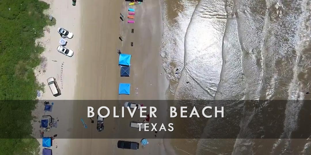
Discover Bolivar Beach, TX
Situated on the upper Texas Gulf Coast, the Bolivar Peninsula is a picturesque and carefree region renowned for its immaculate beaches, plethora of animals, and laid-back vibe. The Texas peninsula, which stretches from Galveston Bay to the Gulf of Mexico, provides tourists with an opportunity to get away from the bustle of the big metropolis and take in the breathtaking scenery of the state’s coastline.
The Bolivar Peninsula’s stunning beaches, which feature miles of silky sand and glistening waters, are among its top draws. In particular, Crystal Beach is a well-liked location for swimming, beachcombing, surfing, and water sports including kayaking and fishing. The beaches on the peninsula are well-known for their peace, making them the perfect place for a quiet getaway by the sea.
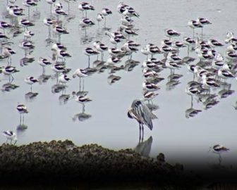
The Bolivar Peninsula is known for its beaches as well as several parks and wildlife preserves where tourists may learn about the region’s various ecosystems. Situated north of the peninsula, the Anahuac National Wildlife Refuge provides chances for hiking, birdwatching, and wildlife observation. Its habitats span from freshwater ponds to coastal marshes. With choices for both offshore excursions and shore fishing, the Bolivar Peninsula is renowned for its outstanding fishing conditions. In the Gulf of Mexico, fishermen can charter a boat for deep-sea fishing excursions or cast a line from a beach, pier, or jetty. Redfish, speckled trout, flounder, and sheepshead are among the frequently caught species.
The Bolivar Peninsula offers some historic monuments and places to see for anyone with an interest in history and culture. Constructed in 1872, the Bolivar Lighthouse provides sweeping views of the environs and acts as a reminder of the peninsula’s maritime history. All things considered, the Bolivar Peninsula provides beachgoers, nature lovers, and fishermen with a serene and picturesque haven. It’s a hidden treasure on the Texas Gulf Coast, with stunning beaches, an abundance of animals, and a laid-back atmosphere.
![]()
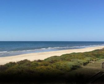
Live Webcams
View live webcams from Bolivar Beach, Texas. Check the current weather conditions, beach activity, and enjoy spectacular sunsets and sunsets. It’s not quite the same as being here but it’s a great way to daydream from far away!
![]()
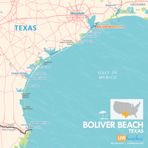
Map of Bolivar Beach & Nearby Beaches
Use the map as a guide to find the best beaches in Texas and locate nearby cities and points of interest.
• Bolivar Beach, TX Map
• Map of Beaches in Texas
![]()
Bolivar Beach, TX Average Temperatures
Wondering the average monthly temperatures in Bolivar Beach, TX? Use this chart below to view the average daily high and low air temperatures including the average ocean temperature per month.
• Average High Temperatures per Month
• Average Low Temperatures per Month
• Average Ocean Temperatures
Bolivar Beach, Texas Average Temperatures
Use this weather chart as a guide to view the average air and ocean temperatures in Bolivar Beach, TX.
The average air temperature in the summer varies between 85-90 degrees.
The average ocean temperature in the summer varies between 80-85 degrees.
| Average High | Average Low | Average Ocean Temp | |
|---|---|---|---|
| January | 68 | 54 | 58 |
| February | 70 | 56 | 60 |
| March | 74 | 62 | 64 |
| April | 78 | 68 | 70 |
| May | 84 | 75 | 77 |
| June | 88 | 78 | 79 |
| July | 89 | 78 | 80 |
| August | 90 | 79 | 81 |
| September | 89 | 77 | 84 |
| October | 84 | 72 | 78 |
| November | 79 | 65 | 71 |
| December | 71 | 55 | 64 |
Average high, low and ocean temperatures in Bolivar Beach. Sources: Accuweather, Weather.com, NOAA Climate.gov.


